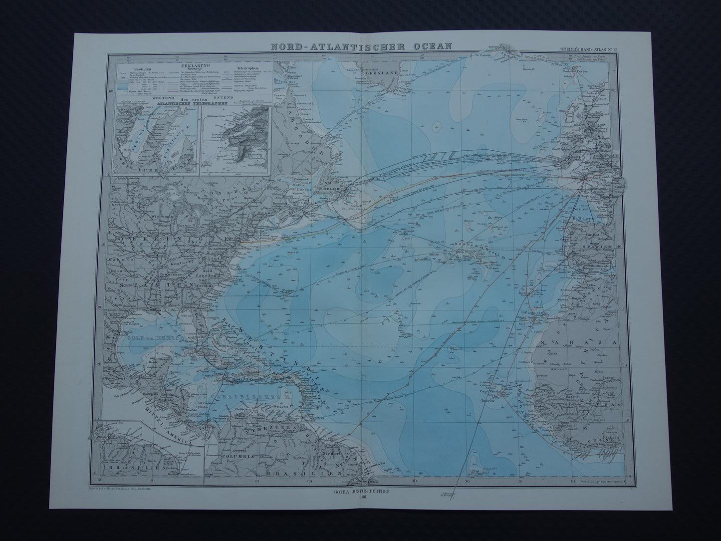
For sale is a beautifully detailed antique map of the Atlantic Ocean from 1880. This German map shows depth (in color and with numbers on the map), submarine and overhead telegraph cables, and major sea routes (both ports and the number of days of travel are indicated for each route). The year 1880 is printed at the bottom of the map.
Dimensions: 37 x 46.5 cm
Condition: In good to very good condition. Paper is fully intact. The map has a center fold, as issued.
Origin:Stieler's Hand Atlas (1880)
ORDER WITHOUT RISK At Oudekaarten.com, ordering is always risk-free. Not completely satisfied with your purchase? You can return it and receive a full refund. Returns are free for Dutch customers.
We sell only original antique and vintage maps. We guarantee that your purchase was made on or around the date stated in the description.
Fast shipping
We will ship your order the next business day at the latest. Free shipping within the Netherlands when purchasing 2 cards. Click here for more information
"Beautiful card, exactly as described. Fast shipping and the card was packaged perfectly. Great transaction, thank you very much!"
ANNE ESCHER
Choosing a selection results in a full page refresh.