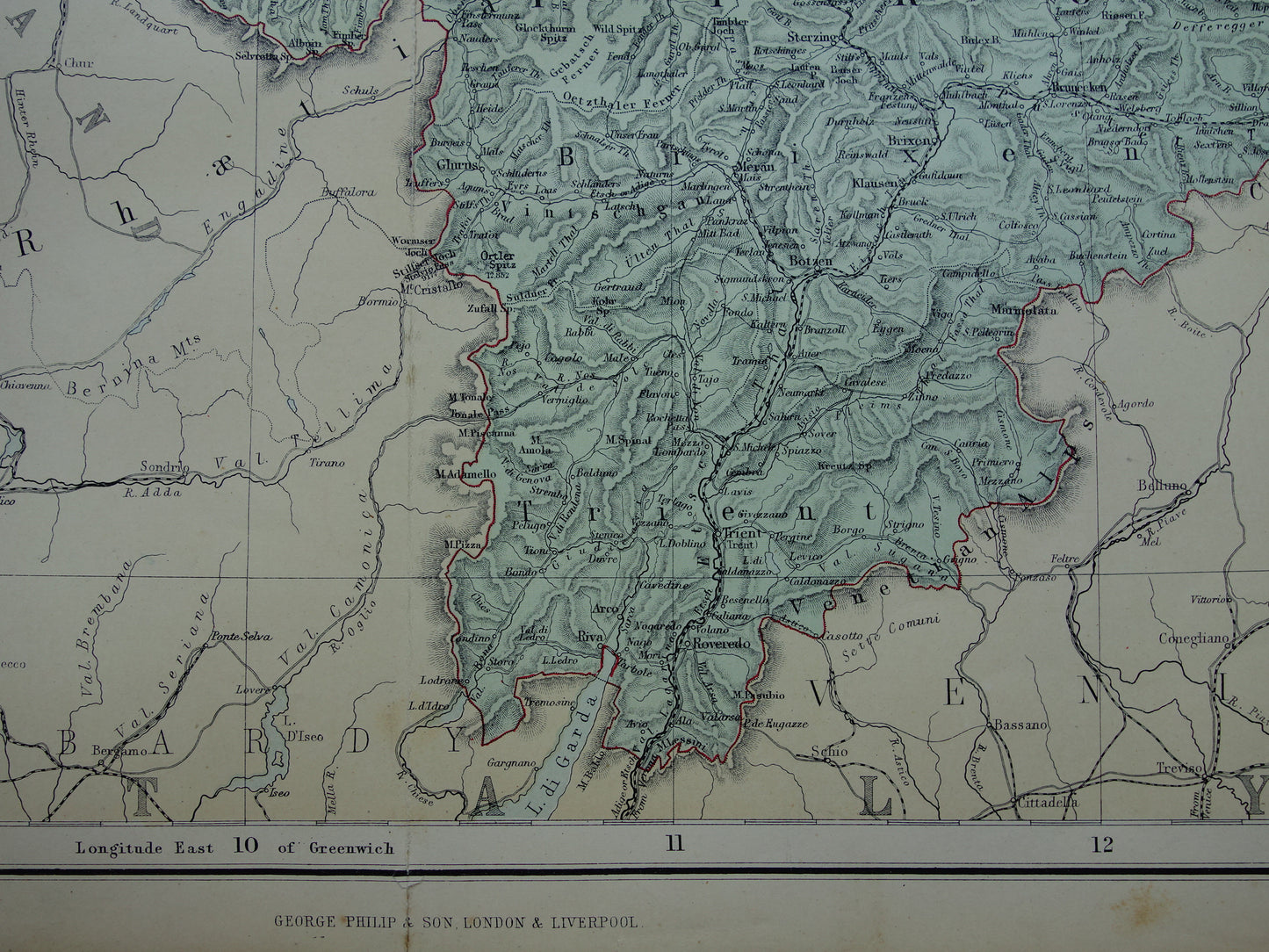
For sale is a large old map of South Germany (and also Tyrol) from the year 1890. This English map is very detailed. Zoom in on the photos to see all the details clearly. In the bottom left, there is an inset map of the entire German Empire.
Dimensions: 55 x 69.5 cm
Condition: some brown age spots, especially in the margins - finger marks in the bottom right corner - a 4 cm tear at the bottom of the central fold (see last photo) - a 5 cm tear along the central fold (at the height of Tyrol, this is hardly visible, see last photo at the top) - another small tear of half a cm at the bottom of the map - all in all, the map is in reasonable condition. Price reduced.
Origin: Imperial Atlas - George Philip & Son - Edition 1890
ORDER WITHOUT RISK At Oudekaarten.com you always order without risk. Are you not completely satisfied with your purchase? You can return your purchase and receive a full refund. For Dutch customers, returns are free of charge.
We sell only original antique and vintage maps. We guarantee that your purchase was made on or around the date stated in the description.
Fast shipping
We will ship your order the next business day at the latest. Free shipping within the Netherlands when purchasing 2 cards. Click here for more information
"Beautiful card, exactly as described. Fast shipping and the card was packaged perfectly. Great transaction, thank you very much!"
ANNE ESCHER
Choosing a selection results in a full page refresh.