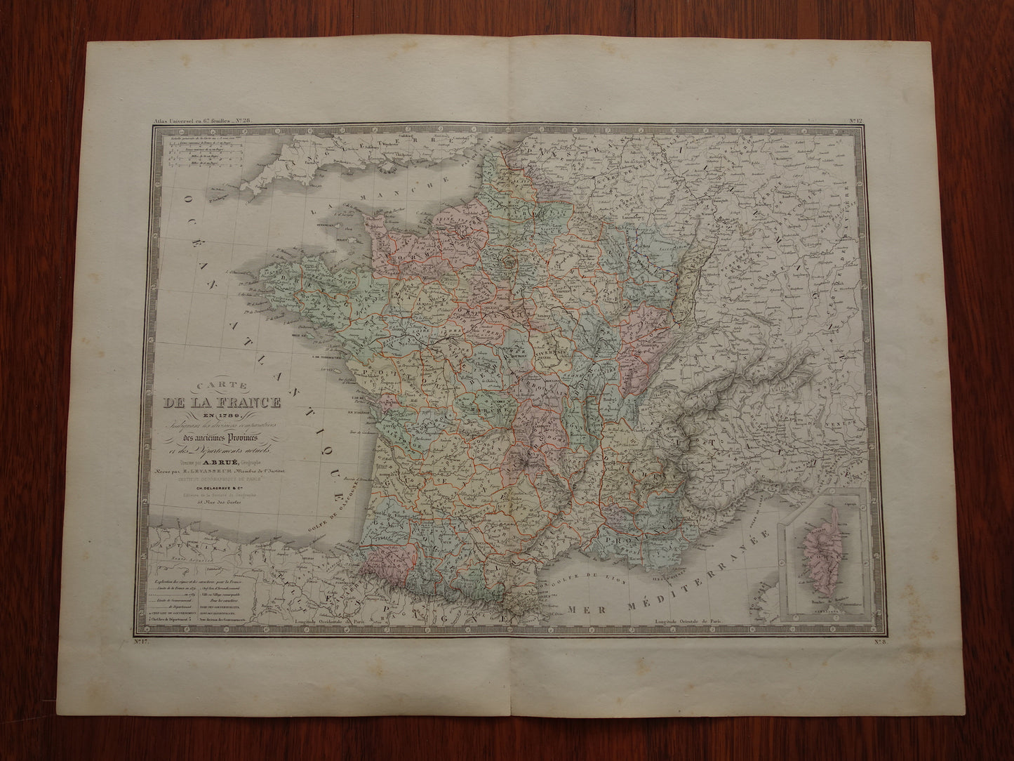
Large antique French map of France in the year 1789 at the beginning of the French Revolution. The map shows the old French provinces and the 'modern' (1876!) departments. The map is hand-colored and has nice wide margins.
Dimensions: 47.5 x 61 cm
Condition: good (= small tear of 2 cm at the bottom of the centre fold - some age spots in the margin - otherwise in good condition).
Origin:Atlas Universel de Geographie - E. Levasseur / AH Brué - Edition of 1876
ORIGINAL ANTIQUE MAP Oudekaarten.com only sells original old maps, we do not sell modern reprints.
ORDER WITHOUT RISK At Oudekaarten.com you always order without risk. Are you not completely satisfied with your purchase? You can return your purchase free of charge and get your full purchase price back.
FAST SHIPPING This card will be shipped within 1 business day.
DISCOUNT AND FREE SHIPPING When purchasing two items, your order will be shipped for free. When purchasing four or more items, you will receive a 25% discount on the total order amount and your order will be shipped for free.
We sell only original antique and vintage maps. We guarantee that your purchase was made on or around the date stated in the description.
Fast shipping
We will ship your order the next business day at the latest. Free shipping within the Netherlands when purchasing 2 cards. Click here for more information
"Beautiful card, exactly as described. Fast shipping and the card was packaged perfectly. Great transaction, thank you very much!"
ANNE ESCHER
Choosing a selection results in a full page refresh.