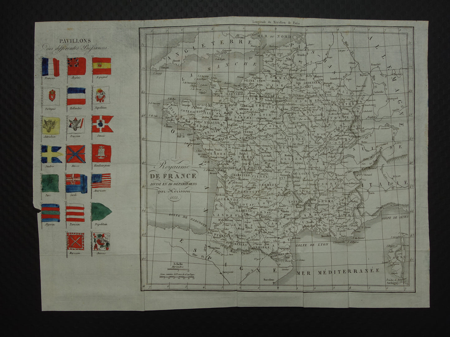
Antique map of France and its 86 departments in the year 1833 (the year is in the title), decorated on the left with flags of different countries. The flags are, rather sloppily, colored by hand.
Dimensions: 29 x 40 cm
Condition: in fair condition. Some minor signs of age, see the photos. The paper has 4 vertical and 2 horizontal fold lines (so that the map could be folded in the atlas). However, these were folded incorrectly in the past and the paper is therefore no longer completely flat. Tear on the left side up to the bottom flag. The imprint of the red flags is vaguely visible around the Channel.
Origin: Nouveau Dictionnaire Geographique Universel - Vosgien - edition 1834
ORDER WITHOUT RISK At Oudekaarten.com you always order without risk. Are you not completely satisfied with your purchase? You can return your purchase free of charge and get your full purchase price back.
We sell only original antique and vintage maps. We guarantee that your purchase was made on or around the date stated in the description.
Fast shipping
We will ship your order the next business day at the latest. Free shipping within the Netherlands when purchasing 2 cards. Click here for more information
"Beautiful card, exactly as described. Fast shipping and the card was packaged perfectly. Great transaction, thank you very much!"
ANNE ESCHER
Choosing a selection results in a full page refresh.