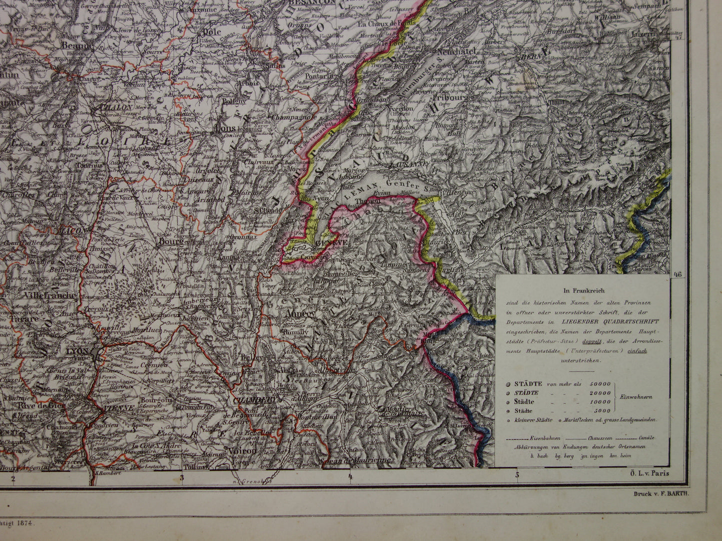
Beautiful, large, antique German map of eastern France in 1874. After the Franco-Prussian War in 1870/1871, Alsace-Lorraine became German territory, which is clearly visible on this map. The map is very detailed; zoom in on the photos for the best view. In the lower left corner is an inset map of the part of northwestern France not visible on the main map. The year 1874 is printed at the bottom of the map. It is a hand-colored steel engraving. It has lovely wide margins and is very suitable for framing.
Dimensions: the card measures 49 x 60 cm
Condition: The map is in good condition, with only minor signs of age and use. Issued with a centerfold. A small tear (2 cm) at the bottom of the centerfold was repaired on the back by the previous owner with tape.
Origin:'Neuer Handatlas' - Heinrich Kiepert - Edition of 1874
ORDER WITHOUT RISK At Oudekaarten.com, ordering is always risk-free. Not completely satisfied with your purchase? You can return it and receive a full refund.
We sell only original antique and vintage maps. We guarantee that your purchase was made on or around the date stated in the description.
Fast shipping
We will ship your order the next business day at the latest. Free shipping within the Netherlands when purchasing 2 cards. Click here for more information
"Beautiful card, exactly as described. Fast shipping and the card was packaged perfectly. Great transaction, thank you very much!"
ANNE ESCHER
Choosing a selection results in a full page refresh.