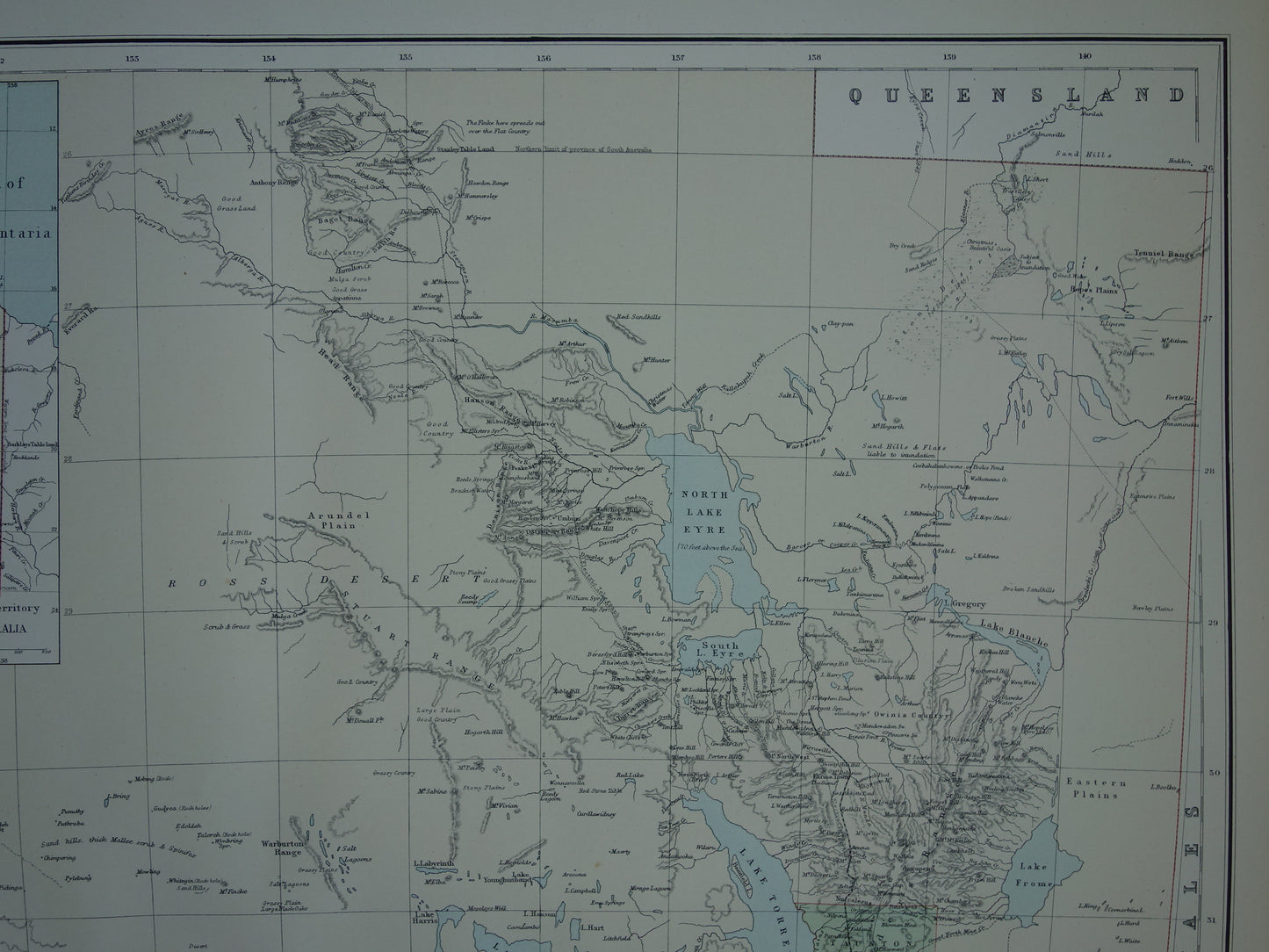
For sale is a large, antique English map of the state of South Australia from the year 1890In the upper left corner is an inset map of the Northern Territory, which at the time was still part of South Australia. The map has many interesting details; zoom in on the photos to see them clearly.
Dimensions: 54.5 x 69.5 cm
Condition: good/very good. Some minor signs of age/use, almost all in the margins.
Origin: Imperial Atlas- George Philip & Son - Edition of 1890
ORDER WITHOUT RISK At Oudekaarten.com, ordering is always risk-free. Not completely satisfied with your purchase? You can return it and receive a full refund. Returns are free for Dutch customers.
We sell only original antique and vintage maps. We guarantee that your purchase was made on or around the date stated in the description.
Fast shipping
We will ship your order the next business day at the latest. Free shipping within the Netherlands when purchasing 2 cards. Click here for more information
"Beautiful card, exactly as described. Fast shipping and the card was packaged perfectly. Great transaction, thank you very much!"
ANNE ESCHER
Choosing a selection results in a full page refresh.