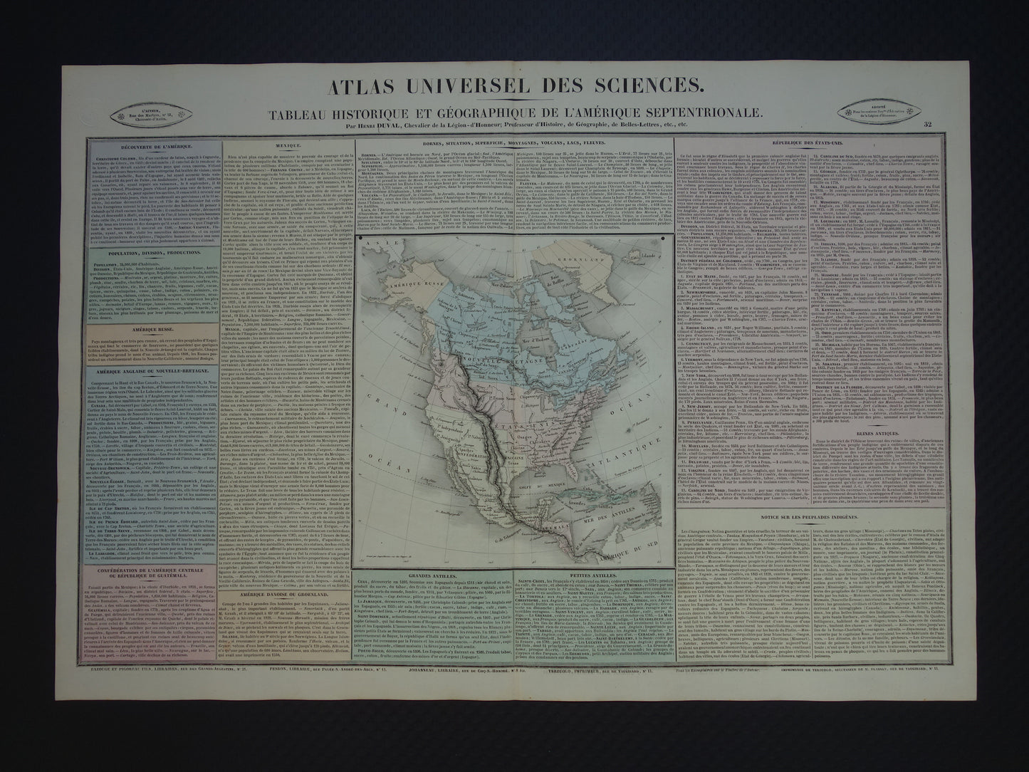
For sale is a beautiful French map of North America. The engraving is beautifully hand-colored and contains a wealth of information about the continent. Among other things:
A list of brief information about each of the 26 states of the US
A list of important rivers, mountains, volcanoes, etc.
Extensive information about Mexico and Mexico City
Very nice for framing.
Dimensions: 41 x 59.5 cm
Condition: very good. With a vertical center fold, as issued.
Origin: Atlas Universel des Sciences - Henri Duval - Paris - 1837
ORDER WITHOUT RISK At Oudekaarten.com, ordering is always risk-free. Not completely satisfied with your purchase? You can return it free of charge and receive a full refund.
We sell only original antique and vintage maps. We guarantee that your purchase was made on or around the date stated in the description.
Fast shipping
We will ship your order the next business day at the latest. Free shipping within the Netherlands when purchasing 2 cards. Click here for more information
"Beautiful card, exactly as described. Fast shipping and the card was packaged perfectly. Great transaction, thank you very much!"
ANNE ESCHER
Choosing a selection results in a full page refresh.