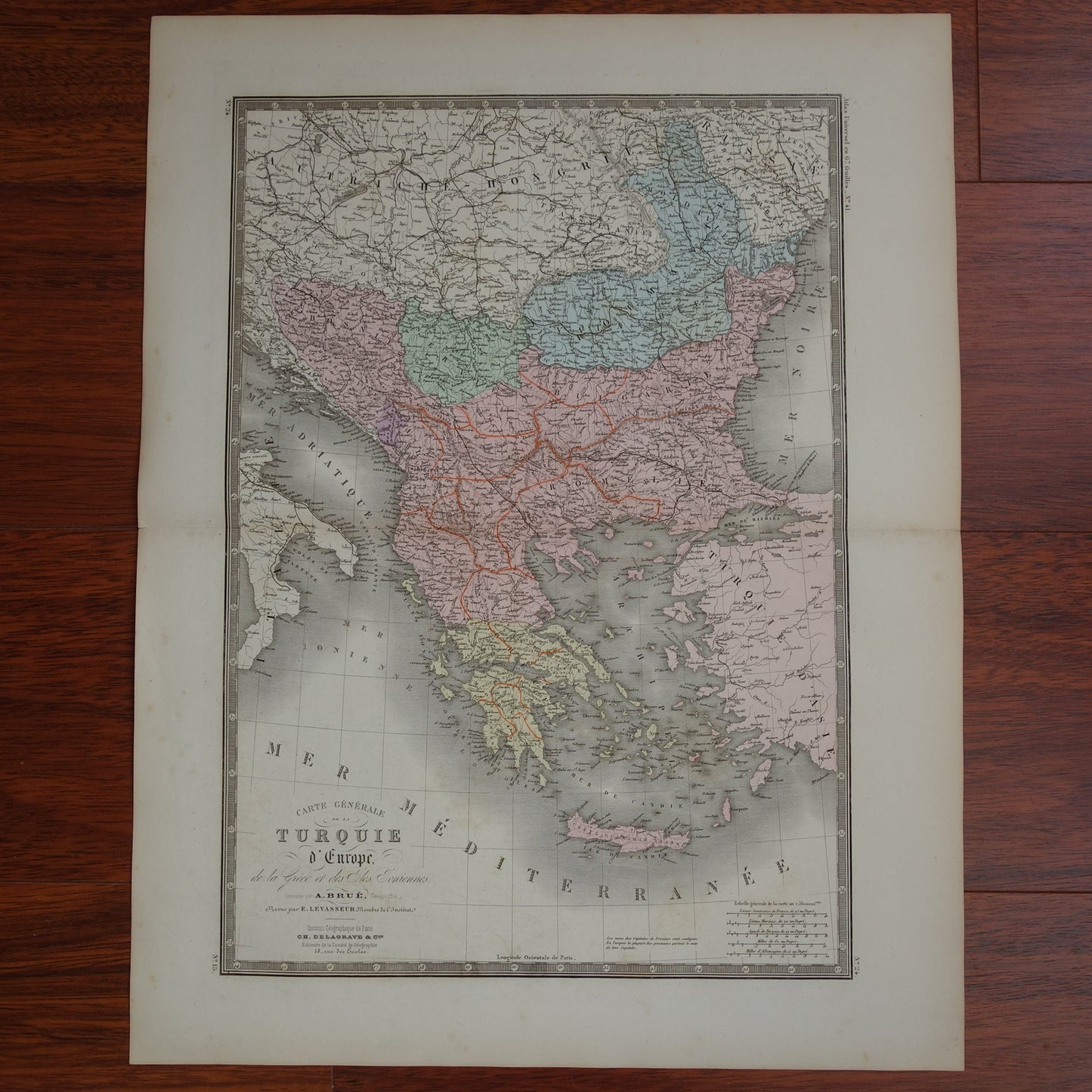
For sale is a large antique map of the European part of the Turkish empire plus Greece from 1876. The map clearly shows the slow disintegration of the Turkish empire. Serbia and Romania are colored differently, because at that time they were no longer an integral part of the empire. Zoom the photos to see the details of the map well. The map is colored by hand. Nice wide margins and very suitable for framing.
Dimensions: 47.5 x 61 cm
Condition: the map has some minor signs of age and use, but is in good overall condition
Origin: 'Atlas Universel De Geographie Physique, Politique, Ancienne Et Moderne' - A. Brué - Edition of 1876
ORIGINAL ANTIQUE MAP Oudekaarten.com only sells original old maps, we do not sell modern reprints.
ORDER WITHOUT RISK At Oudekaarten.com you always order without risk. Are you not completely satisfied with your purchase? You can return your purchase free of charge and get your full purchase price back.
FAST SHIPPING This card will be shipped within 1 business day.
DISCOUNT AND FREE SHIPPING When purchasing two items, your order will be shipped for free. When purchasing four or more items, you will receive a 25% discount on the total order amount and your order will be shipped for free.
We sell only original antique and vintage maps. We guarantee that your purchase was made on or around the date stated in the description.
Fast shipping
We will ship your order the next business day at the latest. Free shipping within the Netherlands when purchasing 2 cards. Click here for more information
"Beautiful card, exactly as described. Fast shipping and the card was packaged perfectly. Great transaction, thank you very much!"
ANNE ESCHER
Choosing a selection results in a full page refresh.